Prikazani su postovi s oznakom travel. Prikaži sve postove

utorak, 7. studenoga 2017.

Geography of Bosnia and Herzegovina


Bosnia and Herzegovina is located in Southeastern Europe, in the western Balkans. It has a 932 km border with Croatia to the north and southwest, a 357 km border with Serbia to the east, and a 249 km border with Montenegro to the southeast. It borders the Adriatic Sea along its 20 km (12.42 mi) coastline.

The most striking features of the local terrain are valleys and mountains which measure up to 2386 m in height. The country is mostly mountainous, encompassing the central Dinaric Alps. The northeastern parts reach into the Pannonian basin, while in the south it borders the Adriatic sea.
The country's natural resources include: coal, iron ore, bauxite, manganese, nickel, clay, gypsum, salt, sand, timber and hydropower.

Regions

The country's name comes from the two regions Bosnia and Herzegovina, which have a very vaguely defined border between them. Bosnia occupies the northern areas which are roughly four fifths of the entire country, while Herzegovina occupies the rest in the southern part of the country.
The major cities are the capital Sarajevo, Banja Luka in the northwest region known as Bosanska Krajina, Bijeljina and Tuzla in the northeast, Zenica and Doboj in the central part of Bosnia and Mostar, the capital of Herzegovina.

The south part of Bosnia has Mediterranean climate and a great deal of agriculture. Central Bosnia is the most mountainous part of Bosnia featuring prominent mountains Vlašić, Čvrsnica, and Prenj. Eastern Bosnia also features mountains like Trebević, Jahorina, Igman, Bjelašnica and Treskavica. It was here that the 1984 Winter Olympics were held.
Eastern Bosnia is heavily forested along the river Drina, and overall close to 50% of Bosnia and Herzegovina is forested. Most forest areas are in Central, Eastern and Western parts of Bosnia. Northern Bosnia contains very fertile agricultural land along the river Sava and the corresponding area is heavily farmed. This farmland is a part of the Parapannonian Plain stretching into neighbouring Croatia and Serbia. The river Sava and corresponding Posavina river basin hold the cities of Brčko, Bosanski Šamac, Bosanski Brod and Bosanska Gradiška.
The northwest part of Bosnia is called Bosanska Krajina and holds the cities of Banja Luka, Prijedor, Sanski Most, Jajce, Cazin, Velika Kladuša and Bihać. Kozara National Park and Mrakovica World War II monument is located in this region.
The country has only 20 kilometres (12.4 mi) of coastline, around the town of Neum in the Herzegovina-Neretva Canton, although surrounded by Croatian peninsulas it is possible to get to the middle of the Adriatic from Neum. By United Nations law, Bosnia has a right of passage to the outer sea. Neum has many hotels and is an important tourism destination.

Rivers

There are seven major rivers in the Republic of Bosnia and Herzegovina:
The Una in the northwest part of Bosnia flows along the northern and western border of Bosnia and Croatia and through the Bosnian city of Bihać. It is a very beautiful river and popular for rafting and adventure sports.
The Sana flows through the city of Sanski Most and Prijedor and is a tributary of the river Una in the north.
The Vrbas flows through the cities of Gornji Vakuf – Uskoplje, Bugojno, Jajce, Banja Luka, Srbac and reaches the river Sava in the north. The Vrbas flows through the central part of Bosnia and flows outwards to the North.

The River Bosna is the longest river in Bosnia and is fully contained within the country as it stretches from its source near Sarajevo to the river Sava in the north. It gave its name to the country.
The Drina flows through the eastern part of Bosnia, at many places in the border between Bosnia and Serbia. The Drina flows through the cities of Foča, Goražde Višegrad and Zvornik.
The Neretva river is a large river in Central and Southern Bosnia, flowing from Jablanica south to the Adriatic Sea. The river is famous as it flows through the famous city of Mostar.
The Sava river is the largest river in Bosnia and Herzegovina but not the largest river that is flowing through Bosnia and Herzegovina. The Sava river flows through Serbia, Bosnia and Herzegovina and Croatia. Sava is used as a natural border between Bosnia and Herzegovina and Croatia and towns like Brčko, Bosanski Šamac, Bosanska Gradiška lies on the river.

Climate

The southern parts of the country have a Mediterranean climate. The Western and the Central parts experience hot and arid summers reaching up to 40 °C while in the winter, temperatures are below freezing with lots of snow. The north-eastern region has a typical continental climate.

ponedjeljak, 6. studenoga 2017.

The canyon of the river Rakitnica


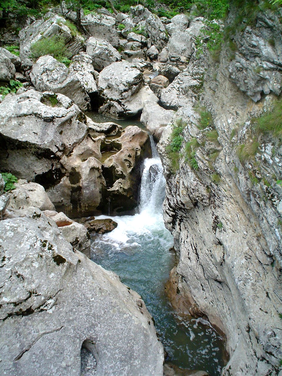
The river Rakitnica is probably one of the largest confluent of the river Nere­tva. Its canyon is almost inaccessible, but extremely beautiful. It is almost 26 kilo­meters long.
The water that flows thro­ugh the canyon is crystal clear. It is clean so that it is possible to drink it. This area is full of endemic species of flora and fa­una. The canyon stretches between the mountains Bjelašnica and Visočica that are situated southeast from Sarajevo.
This is probably one of the deepest river canyons in Europe. In that terrain we can find bears, wolves, wild boars, martens and chamoises. The canyon of the river Rakitnica is still unexplored, because there have been only a couple of expe­ditions until now.
The biggest attraction is placed in the upper stream of the river Neretva, near Konjic. This area is conve­nient for rafting because of its numerous wild rapids. To get to rafting, you can use the same road you would use to get to Boračko jezero. The complete experien­ce gives you the sense of relaxation. The mere view represents an adventure.
The pure water, the wild surrounding and the river rapids will make your vacation unforgettable, for sure.

nedjelja, 5. studenoga 2017.

The Olympic mountain Bjelašnica


Bjelašnica is a mountain in central Bosnia and Herzegovina. It is found directly to the southwest of Sarajevo, bordering Mt. Igman. Bjelašnica's tallest peak, by which the whole mountain group got its name, rises to an elevation of 2067 meters (6782 feet). Other notable peaks are Krvavac (2061 m), Mali Vlahinja (2055 m), and Hranisava (1964 m). The Bjelašnica range is bordered by the Rakitnica in the south, the Neretva in the west, Mt Igman in the north-east and Mt Ivan in the north-west. Only at 20 minutes distance of Sarajevo, it is a popular tourist attraction for hiking and skiing.
Bjelašnica has been, in certain areas, the site of extensive combat during the 1992-'95 Siege of Sarajevo and particular areas pose a high mine risk. There are numerous trails set up and maintained by local mountain clubs that lead to the bald peaks higher up. The mountain is also popular with mountain bikers and has become recently a frequent base for paragliders.
The mountain's name stems from the root bijel, which means "white". The white snow cupola of Bjelasnica is a familiar sight from the higher points in Sarajevo in the period from mid October until early June. Bjelašnica's base is largely forested - mixed forest, mostly beech - however there are no trees above the 1500 meter (4921') tree line.
Bjelašnica summit is easily recognized from the distance by the structures that have been erected on top of it. After the Austro-Hungarian Empire occupied Bosnia following the Congress of Berlin in 1878 the Austrians installed almost immediately the first meteorological station on the summit in 1878, creating the first meteorological station in the whole area of the Balkans. This structure was replaced in 1894 by an - at that time - very advanced meteorological observatory with an all-year around manning.
The observatory is still there, has been repaired of the damage sustained during the last war, and still functions as an important chain-link in the meteorological survey of the Balkans. The communications Centre with its landmark tower that used to stand next to the observatory was destroyed in 1993. The sad remains of the broken tower were removed in 2006.

Olympic games

During the 1984 Winter Olympics, Bjelašnica hosted the men's alpine skiing events, where brash Bill Johnson (USA) won the downhill after boldly predicting victory, overtaking Swiss ski legend Peter Müller who took silver. The American twins Phil and Steve Mahre took gold and silver in the slalom at Bjelašnica for the US as well. Switzerland's Max Julen surprisingly took the gold in the Giant Slalom, while the silver went to the Yugoslav favorite Jure Franko. Major investment was done by the Yugoslav authorities in order to accommodate the Winter Olympics.
The Babin Dol area was developed for the necessary construction and a long main ski lift was built from Babin Dol up to the summit of the Bjelašnica summit. In preparation of the Games, a road was constructed across the Igman plateau connecting Sarajevo through Hadžići to the Malo Polje, Veliko Polje and Babin Dol venues. The Babin Dol area has several structures dating from that time, including the renowned Maršal (then: Famos) Hotel and most of the skiing facilities in the area.
FIS World Cup events took place on 18 January 1983 and 21–22 March 1987. In 1983 it was only the downhill (winner: Gerhard Pfaffenbichler, before Steve Podborski and Franz Klammer) that was done. In 1987 contests were done in Men's Slalom (winner: Grega Benedik) and Giant Slalom, Men's (winner: Marc Girardelli) and Women's (tied victory: Maria Walliser and Vreni Schneider) Other FIS events have taken place and are still taking place at Bjelašnica.

The Bjelašnica Olympic Mountain Ski Centre

The Bjelašnica Olympic Mountain Ski Centre and its facilities are all located on the eastern slope of Bjelašnica main summit. There are 6 lifts, with one modern three-seat carrier lift departing from Babin Dol, three anchor lifts and two remaining single saucer lifts. Next to the original 3100 meter Olympic Downhill run and the Giant Slalom run there are four more pistes varying in length between 3200 and 550 meters and covering all difficulty levels between bleu-red-black.
A lot of investment has been done to develop the Ski Centre and the Babin Dol area since the era directly following the Dayton Agreement, with another peak during the last couple of years. New hotels, apartment complexes and restaurants have turned this area into a modern ski resort.

Hiking

The Bjelašnica range consists of basically three ridges, the Vlahinja ridge, the Strug ridge and a more southern ridge parallel to the Rakitnica and separated from the other ridges by a wide valley called Dugo Polje. A number of popular hikes exist in these mountains. One trail approaches the Bjelašnica main summit (2067 m.) from the north and is called Josipova Staza after its most famous hiker: Josip Broz Tito.
From the main summit a ridge walk leads north-east towards the summit of Mala Vlahinja (2055 m.). The last summit of this ridge in the west is called Hranisava (1964 m.) and can be better ascended to by a trail starting in the hamlet of Lokve, between Hadžići and Pazarić. This offers a beautiful hike towards a fantastic view from this most western summit of the Bjelašnica range.
Another beautiful hike departs from Dugo Polje and leads via a difficultly retrieved trail through thick shrubs of Pinus Mugo the summit of Krvavac (2061 m.). One of the most popular hikes leads parallel to the Rakitnica Canyon, departing from Umoljani and ending at Lukomir, known to be the last all-year-through inhabited semi-nomadic settlement at this altitude in the Balkans.
There is quite a number of well equipped mountain huts to be found within this mountain group. Stanari P.D. (1540 m.) is an excellent base for hikes in the central-western part of the mountain range. There are other mountain huts at Sitnik, Umoljani and Lukomir that might require prior reservation.

petak, 3. studenoga 2017.

The Boracko lake


          The lake Boračko jezero is located on the northeastern side of the mountain Prenj, at the altitude of 405 meters. It is about 21 kilometers away from the main road. That is the larges mountain lake in BiH. It has an elliptic shape. It is about 786 meters long. It is one of the most beautiful natural lakes in BiH. A brook called Borački potok pours into the lake, and a little river called Šištica pours out. There is a waterfall on this river and it is over 30 meters high. The area is full of evergreen and broadleaf trees.
           There are fish like carps and brook, lake and Californian trout. The lake has also been famous for the river crabs. According to the legend, the lake has been formed after a great storm that lasted for a couple of days. The brook stream fills the water with oxygen, which makes the lake convenient for the life of many different organisms. The waves do not rise above 0,7 meters because the lake is not very long. That offers the conditions foe swimming and other water sports on calm water.
            Due to the average monthly temperatures of the water, it is possible to swim in the lake in June, July, August and even September at the temperature of 18 degrees. By the sedimentation of very tiny particles, at the bottom of the lake, a very thick mud has been formed and it represents danger for divers. Boračko jezero is surrounded by ------forests and there are broadleaf woods nearby, perfect places where one can relax in the fresh air. 
             The treetops of the pines that have been shaped by the nature make the woods around the lake very interesting and attractive. There are several boarding houses near the lake, and several spots for camping.
               This place is an ideal place for a vacation or the preparations of athletes. It is a real heaven for the anglers.